Riaba
Riaba is a town in Equatorial Guinea. It is also the 30th largest settlement in the country. It was founded in 1779 under the name of Concepción by the frigate lieutenant Guillermo Carboner. It was reestablished by the British in 1821.
It is located in the province of Bioko Sur.
It has a (2005 est.) population of 1,071.
It is located in the province of Bioko Sur.
It has a (2005 est.) population of 1,071.
Map - Riaba
Map


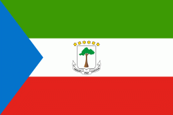
Country - Equatorial_Guinea
 |
 |
| Flag of Equatorial Guinea | |
Equatorial Guinea consists of two parts, an insular and a mainland region. The insular region consists of the islands of Bioko (formerly Fernando Pó) in the Gulf of Guinea and Annobón, a small volcanic island which is the only part of the country south of the equator. Bioko Island is the northernmost part of Equatorial Guinea and is the site of the country's capital, Malabo. The Portuguese-speaking island nation of São Tomé and Príncipe is located between Bioko and Annobón. The mainland region, Río Muni, is bordered by Cameroon on the north and Gabon on the south and east. It is the location of Bata, Equatorial Guinea's largest city, and Ciudad de la Paz, the country's planned future capital. Rio Muni also includes several small offshore islands, such as Corisco, Elobey Grande, and Elobey Chico. The country is a member of the African Union, Francophonie, OPEC and the CPLP.
Currency / Language
| ISO | Currency | Symbol | Significant figures |
|---|---|---|---|
| XAF | Central African CFA franc | Fr | 0 |
| ISO | Language |
|---|---|
| FR | French language |
| ES | Spanish language |